
We begin week 5 amazed that we’ve already been on our adventure for a month and inspired by all that we have learned. The kids are spotting examples of European and African art and architecture all around us these days, which is great to see. We set up our map and globe to begin our week on Asia and decide to examine them a bit before we read about its countries.

Thye are impressed at the size of China and notice how many of the countries are actually islands. The kids take turns feeling the surface of the globe to find the largest mountain peaks. (HZ uses a little flashlight to find the right spot!) They quickly locate the Himalayas and so we turn to the book Sacred Mountain Everest to learn more.
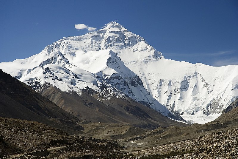
We learn that the Himalayas cross over several countries in Asia and that Mount Everest, its highest peak (and the highest peak in the world at 29,035 feet above sea level), is located between Nepal and Tibet. The people of Nepal call the mountain Sagarmatha (Goddess of the Sky), while the people of Nepal and China call it Chomolungma (Goddess Mother of the World). We read that the mountain was considered very sacred, and that the people who live on the mountain are called Sherpa. They have adapted to be able to live at such a high altitude.

We read about the terrain and see pictures of animals that live on the mountain–some, the Himalayan tahrs and the red panda, that we have never seen before. We learn that the base of the mountain is fertile, with rhododendrons growing to 30 feet tall! As you travel up the mountain, the trees get smaller and by 15,000 feet only small plants can be found. Above 18,000 feet the mountain is covered with snow and the conditions become increasingly difficult for climbers and at 25,000 feet temperatures can fall to -100 degrees. Very few have successfully climbed Mount Everest. Interestingly, we learn that the mountain grows in height by about 4 millimeters per year because the plate shift that caused the mountain to form 8 million years ago, continues to occur slightly each day.

The kids take notes in their journal as we read a bit about the Middle East and the Far East in our Children’s Atlas. We learn about the varying terrain and climate, from snowy mountain peaks to dry desserts and flooded fields, perfect for growing rice. AZ is especially interested in learning more about the Chocolate Hills in the Philippines, although she is quickly disappointed to learn that no actual candy is involved–these 1,268 grassy hills got their name because they turn a chocolate brown color at the end of each summer. We learn about Monsoon season and the heavy rains and hurricanes it brings and the that some areas receive very large amounts of rain, like Indonesia, where the average is 7-11 inches of rain per month.

The kids end the night by reading a bit about some of the countries of Asia on their own. With such a vast territory and so many inhabitants (1/5 of the World’s people live in China!), it’s not a surprise that there is a wide range of cultures and traditions across the countries of Asia. We look forward to learning more about them throughout the week!
